Treasure hunting is one of the biggest problems worldwide and causes many problems in the field of archaeology and cultural heritage. As someone who has spent years in archaeological sites, I can say that treasure hunters pose a danger not only to cultural heritage but also to local archaeologists and the armed forces of the region. They often carry weapons with them and tend to use them to protect themselves. There are various remote sensing studies on the detection of treasure pits, but these studies have mostly been carried out with optical sensors or have been conducted in an already known area. Although there are very few studies conducted with SAR images, the dimensions of the pits detected are generally large. For this reason, we conducted an experimental study at Wuhan University in order to find the smallest pit that can be detected with SAR images. That was going to be my main topic of PhD degree thesis.
Treasure hunters digging random holes and stealing artifacts and selling them in the black market and this causes a great loss in terms of cultural heritage. Its hard for archaeologists to stop them since treasure hunters are armed. So detecting looting activities with remote sensing may help for future solutions on informing local police and soldiers. It is not easy to detect such activities while they are taking place. For this reason, it is very critical to detect the incident as soon as possible after it occurs. Because sometimes treasure hunters carry out excavation work at a certain point for days or even weeks. Catching them red-handed is important for cultural heritage. Of course, it is also important that there are laws to protect cultural heritage in the country where the incident took place and that the penalties given to treasure hunters are serious. Deterrent penalties should be given.
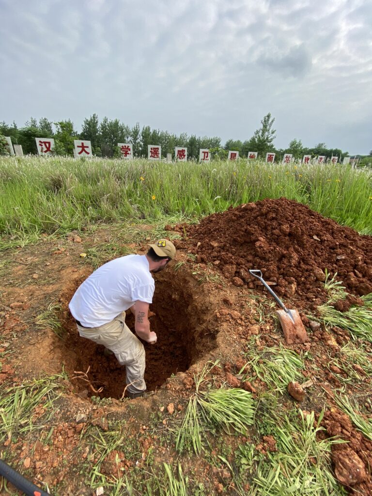
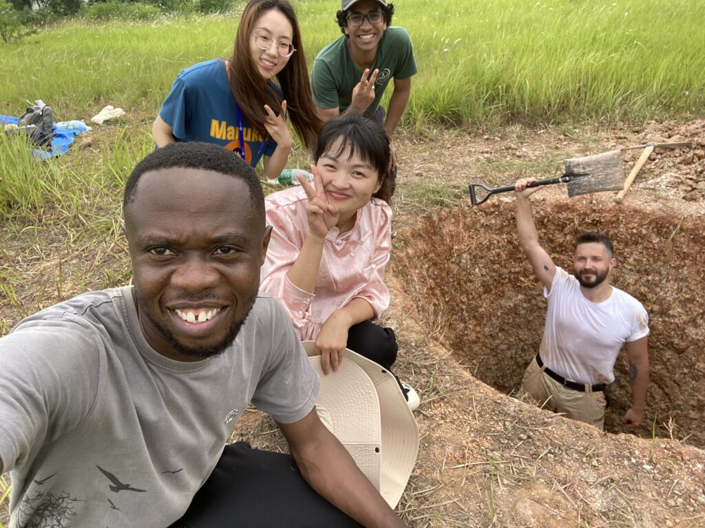
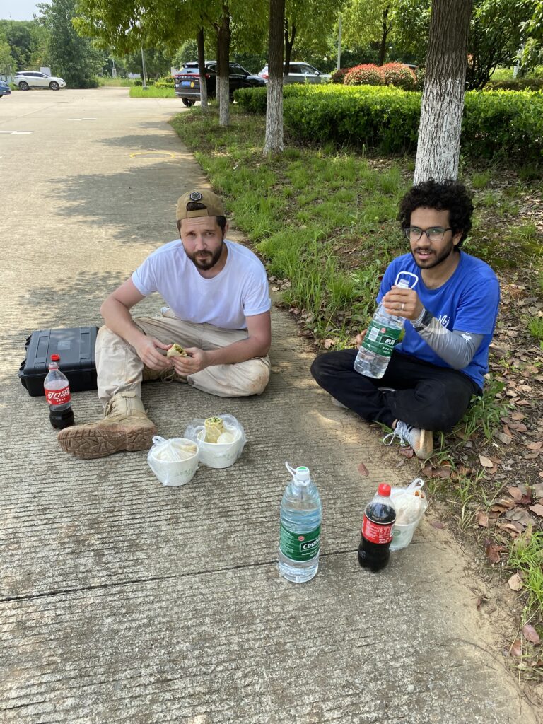
In our experimental study, we wanted to find the smallest treasure pit that could be detected by digging artificial treasure pits on the field of Wuhan University. So, i asked help from my good friends Mostafa and Chike. We bought the equipments and start working on it. All through summer, time to time we went to field and start digging. Everytime we went, we just burned out from hot weather, worked under sun in 40 degree summer days.
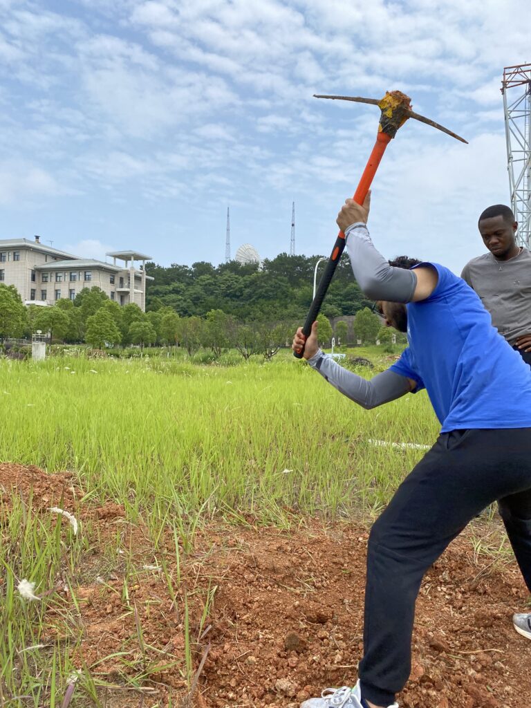
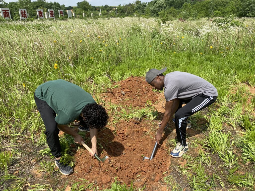
Main idea was digging holes with different measurements and trying to see the pits in SAR images. We had to do the work during the hot days of the summer because we needed to keep the risk of rain to a minimum. So, we dug 2 different holes in 2 different area and then after some time shaped the second hole into different sizes to have different measurements.
Check out our video report below!
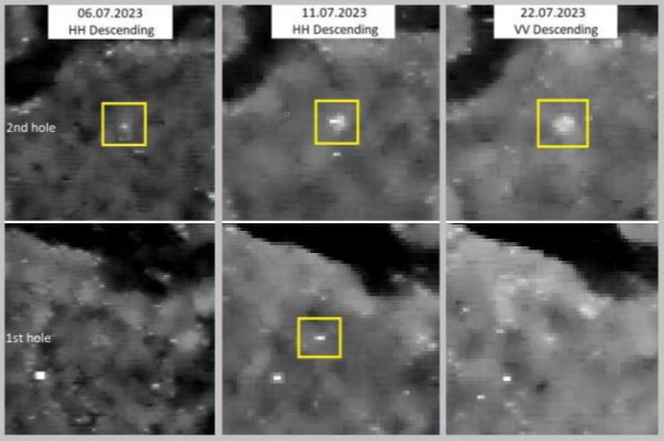
First hole was 1 meter wide 1 meter deep. Soil wasnt so hard but still took some time to finish it. We wanted to detect the smallest looting hole that could be detected. For the second hole, we went to nearby area in the same field. The soil was completly out of compressed clay and it took so many days to finish the excavation. We dug 2×1 meter first, then we changed size to 2×2 meter and 3×1.2 meter. Everytime we finished a hole, we collected SAR images from satellite. We have used TerraSAR-X images for this study. TerraSAR-X can achieve below 1 meter resolutions which was critical for detecting small looting holes.
There was one problem occurs once in a while, which is rain. When it rains in Wuhan, the holes were filling with water, specially the second hole. Since the second hole’s is mostly compact clay, water were staying in untill we bucket it out. This problem was affecting the results by disappearing the hole in the images.
As a result of acting like a treasure hunters, even it wasnt easy, we realize that it is possible to detect even 1×1 meter looting hole by using SAR satellite. Of course, with the high resolution images. When it comes to bigger measurements, it was even more clear. Also, when we compare it with other studies (which they werent experiments), we realize one more thing; soil waste.
Since the SAR take images from side angle instead of the top, the soil we dug out and throw to the side of the hole was affecting the results. When we realize it, we changed the position of the soil and checked the results. Results showed us it was effective!
Results showed us it is technically possible to detect smallest looting holes with SAR images, but ofcourse with some weaknesses. The place we dug was free of trees and bushes. So when we include them, it will be much harder to do the detection. You can see that in only one image, we were able to see the 1st hole (lower row). When it comes to the 2nd hole (upper row), it was much easier to observe some backscatter.
Another issue to consider is: WHY SAR? SAR images have various advantages, but sometimes it can make things more complicated due to the expertise it requires. In an open area with no trees, using SAR images may be unnecessary, but in cloudy weather, optical images will have no function. In other words, it is difficult to say whether SAR or optical images are better. It would be healthier to produce a solution according to the scenario.
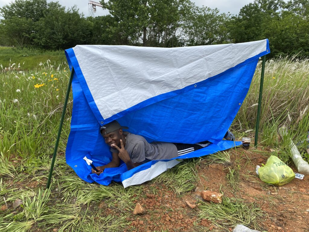
One Turkish, one Egyptian and one Nigerian digging holes in China sounds a bit interesting which made this experiment more fun. Experiment was fun and the results were helpful. Thanks the professor and friends, we spend some dirty days for science. Hope to get dirty again soon with the team!